|
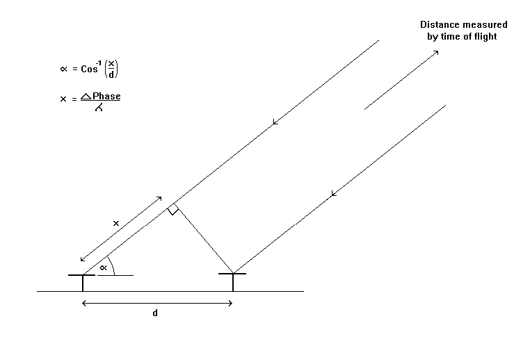
The picture shows the general principle for determining the echo location or
sky-map position of an echo. The figure illustrates the case for two spatially
separate receiving antennas where the position is determined in a direction
in the plane of the antennas. The two antennas are typically sampled by the
two AIS receivers simultaneously so that the phase difference between them
can be directly related to sky-map position.
|
 |
| Using orthogonal pairs of receiving antennas (e.g. north-south aligned and east-west aligned) for consecutive transmitted pulses allows the sky-map position to be determined in two different directions and the full 3-D echo location to be determined (north position, east position and range). See Dudeney and Jarvis (1986). |