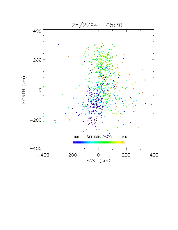
| Dynasonde data can also be displayed in the form of a "sky-map" which shows the horizontal location of each echo. In the example shown here, each echo is colour-coded according to its line of sight Doppler velocity towards (blue) or away (red) from Halley; the velocities (colours) indicate a strong horizontal ionospheric flow towards the NNE. | ||
 |