
All picture locations and view directions are approximate.
See bas_publ for satellite views.
Note: please note that these pictures are of an event that occurred in the 94/95 season. As far as we know, nothing particularly significant has happened in the area subsequently.
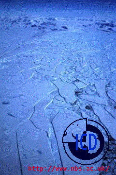 Picture taken approximately 10 km N of Robertson Island, looking WNW.
In the far background the mountains of the Antarctic Peninsula can be seen.
The land to the Right is Cape Longing (I think).
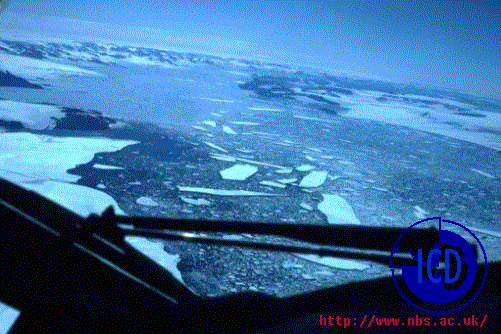 Picture taken at Cape Longing, looking ENE.
The land in the "foreground" to the left is C. Longing; to the
Right in middle distance is James Ross Island; in
the distance the Peninsula.
In the center, the channel between James Ross Island
and the Mainland is free of shelf ice for the first time in
recorded history (which is about 100 years, around here).
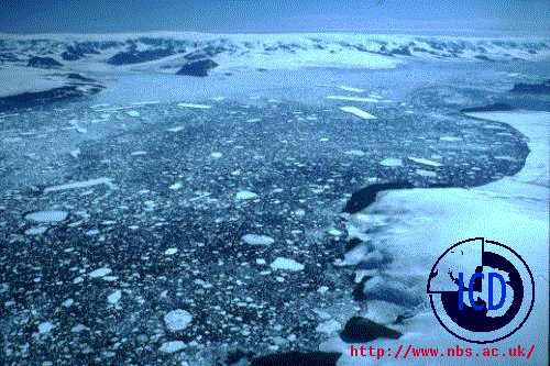 Picture taken over the SW tip of James Ross Island looking NNW.
In the Right foreground, James Ross Island.
In the distance, the Peninsula.
In the middle, the James Ross Channel.
Conditions for use: the pictures may be re-used on other sites if the BAS logo is retained and a link back to BAS inserted in the borrowing site. All photos remain BAS copyright.
Page by: WMC