 Other Peoples Pages
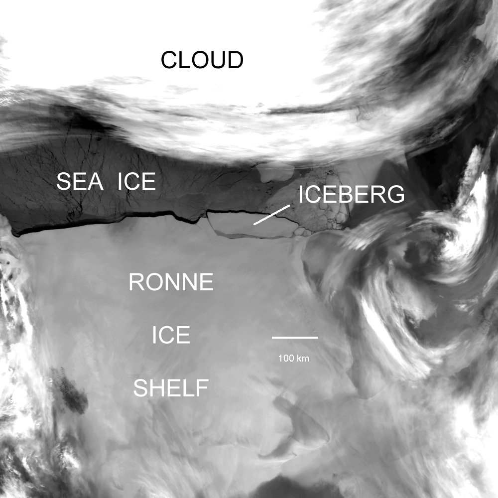
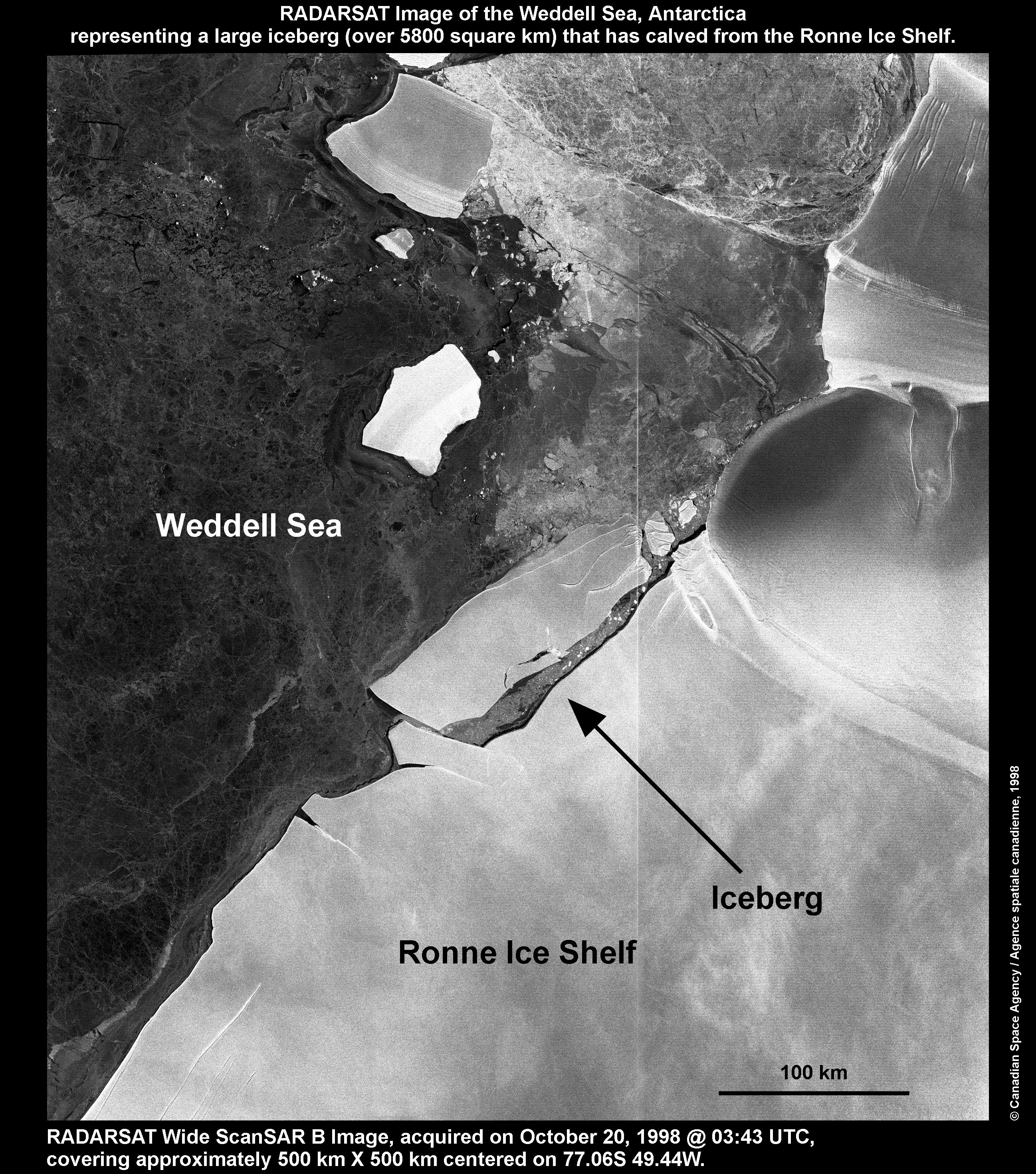
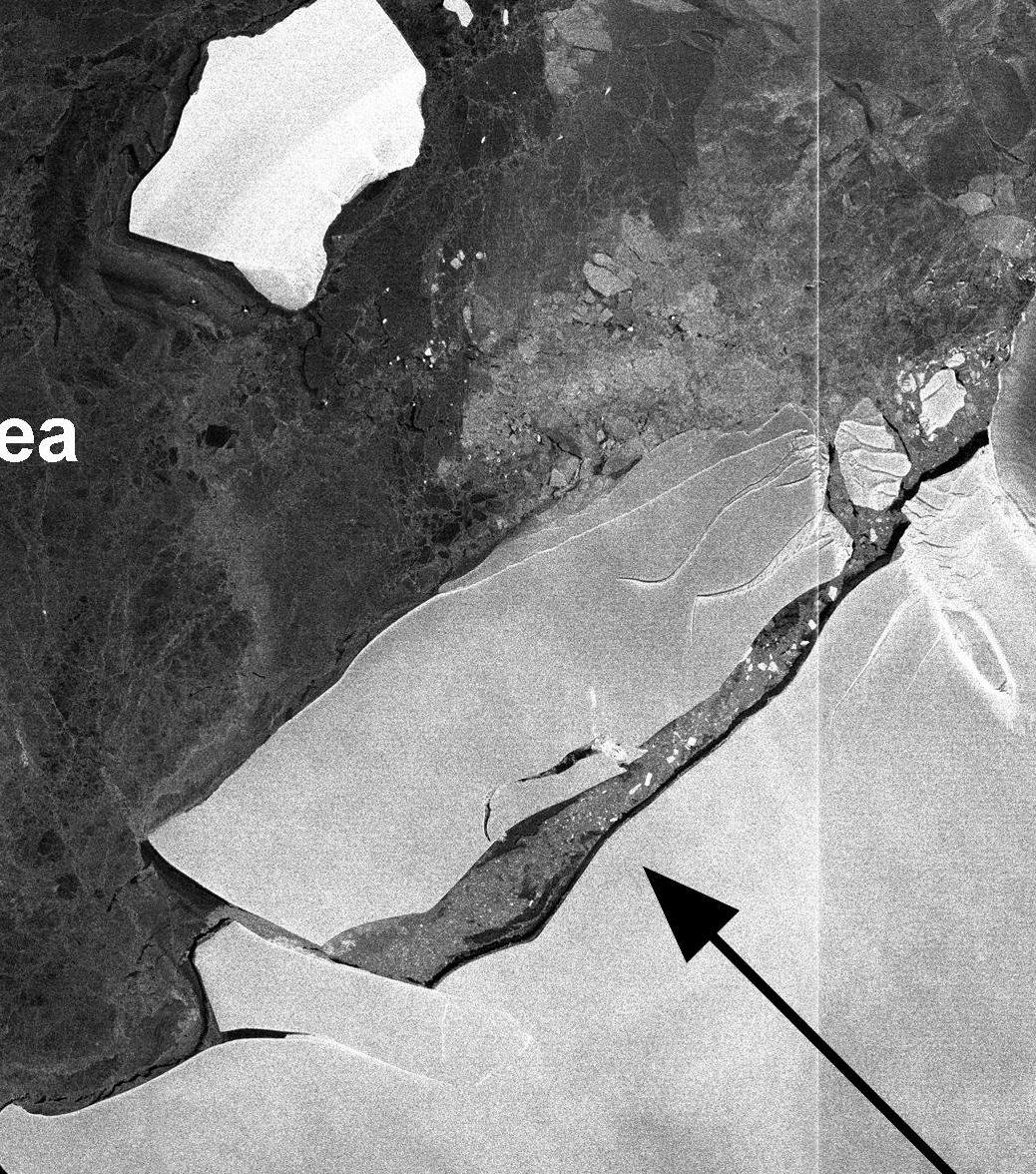
Images of Ronne-Filchner calving event, October 1998
There are various images and 1 map in this directory:
From 13/20/1998
We have 5 versions of one image:
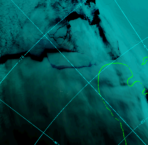
- ronne.gif (330k; 850x850) - image navigated; lat-lon's added
- ronne.jpg (76k; 850x850) - same as above but jpg
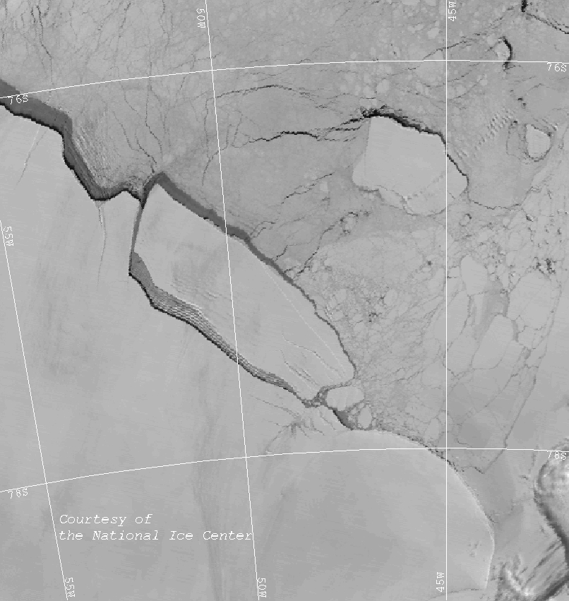
- ronne-label.gif (423k; 1000x1000) - image with explanatory text added
- ronne-label.jpg (121k; 1000x1000) - same as above but jpg
- ronne_sm.gif (57k) - same as #1 but 300x300
they show an iceberg (now named A38) calving from the Ronne iceshelf.
A press release and scientific info describing the event is
available.
The image is channel 4 (IR).
Others
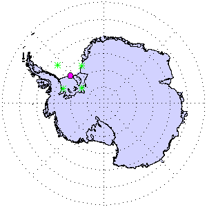
- location-map.13-10-1998.300.gif (8k) - location map - the purple dot
represents the location (but not size!) of the berg; the green crosses mark the approximate
corners of the picture "ronne.gif" (according to my calculations...)
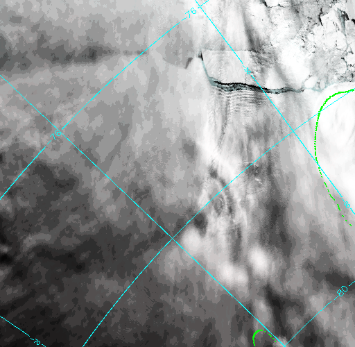
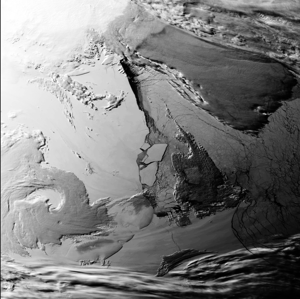
- ronn_11.gif [11/10/1998] [RAL] 2 days earlier than our image.
Navigated and with Berkner island outlined in green, which helps location. Glaciologically
shows nothing new, but very interesting meteorologically - look at the bands visible just inland of the
berg (and in the gap too). Unlikely to be anything other than clouds.
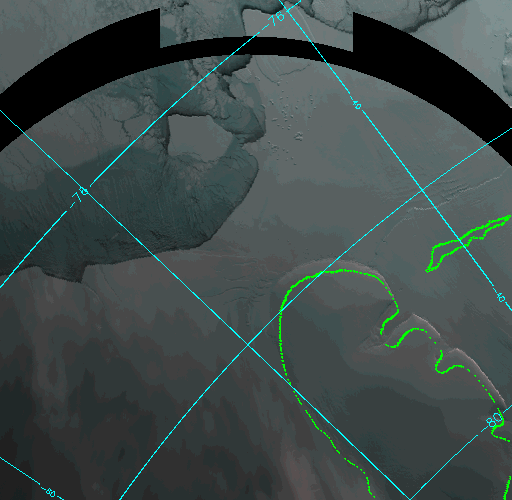
- ronn_20.gif [20/09/1998/] [RAL] This is pre-calving but
rather dark & you don't see much. The "edge" is not the ice front, but the edge of the fast ice.
- A few more unsorted from here [RAL].
- ronn15oct.gif [15/10/1998] [RAL] 2 days after our image.
- 03-11-1998.jpg (600k; 1002x1000) - shows the berg broken up; and also a
rather nice mesocyclone over the iceshelf
Images [RAL] are from
the Rutherford Appleton Laboratory (RAL) from the
ATSR instrument,
courtesy of Nigel Houghton.
The ATSR link will provide technical information about the
ATSR.
The ATSR images here are enhanced (= brightened) colour composites from wavelengths 0.87 , .67 and .55 microns.
Smaller version and map
The smaller image from the 13th and the location map are displayed below:
In Austral summer 94/95 the ice shelf around James Ross Island disintegrated and parts of the Larsen ice shelf calved.
This is documented at http://www.nbs.ac.uk/public/icd/bas_publ.html. Please do not confuse the 2 events...
Perhaps this is a good point to remind people about the
naming of icebergs.
Other Peoples Pages
I guess other people will put up stuff too. When I find it I'll try to link it in.
Calving event spotted by Mark Jefferey at Rothera - thanks Mark!
|
Page creation by WMC
|
Image manipulation by TLC/JT
